
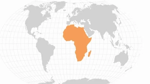

The United Nations General Assembly has voted to support a new world map that more accurately represents Africa’s size. The “Correct the Map” resolution, sponsored by Togo and backed by African Union members, received support from 164 countries.
France and the United Kingdom supported the resolution, while the United States voted against it. Six countries abstained from the non-binding vote, which could encourage institutions worldwide to reconsider the maps they use.
UN Challenges Centuries-Old Map
The resolution targets the widely used Mercator projection, which Flemish cartographer Gerardus Mercator created in 1569 for navigation. The map distorts the size of landmasses, making regions near the poles appear much larger than they actually are.
As a result, Africa appears roughly similar in size to Greenland, despite being about 14 times larger. Critics argue that this distortion can influence perceptions of Africa’s importance, development needs and economic potential.
Cartographers Seek Fairer Representation
Cartographers developed the Equal Earth projection in 2018 to address the size distortions found in traditional world maps. The projection preserves the relative areas of continents more accurately while presenting the globe on a two-dimensional surface.
In February, all 54 African Union member states adopted the Equal Earth projection. The bloc said the map provides a more accurate representation of continental sizes, particularly Africa.
Meanwhile, campaigners supporting the initiative highlighted Africa’s enormous landmass. The #CorrectTheMap campaign said several major countries and large parts of Europe could fit inside Africa while leaving additional space.
Togolese Foreign Minister Robert Dussey also backed the campaign before the vote. He said a fair world should begin with a fair map, reinforcing calls for greater accuracy in global geographic representation.